FLOW BOULEVARD
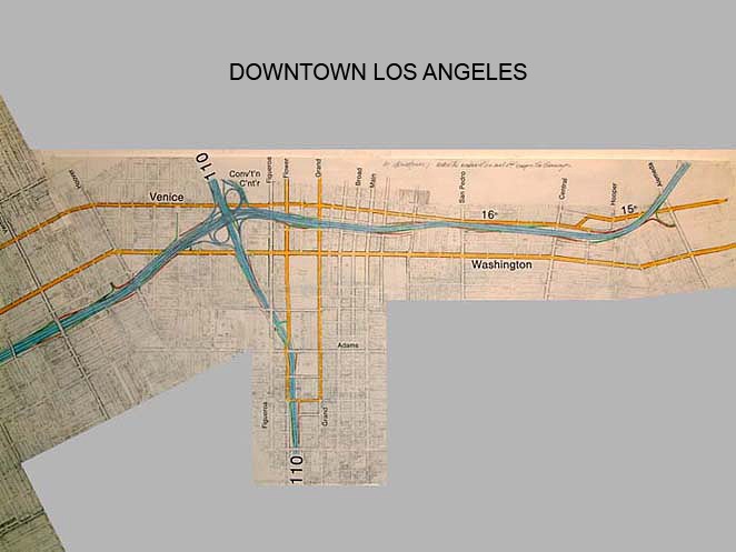
Venice Washington FB and Sepulveda FB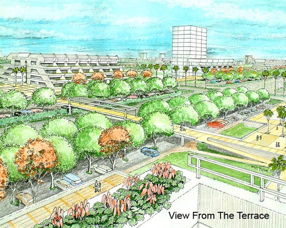
Abstract
Several new relationships are being identified between the Flow Boulevard and the adjacent community; new city block organization, block corporation development entities, relief to local and freeway facilities, and the need to provide a hierarchy of roads that protect the adjacent existing residential communities as well as future community organizations. Three Flow Boulevard corridors are given a preliminary look in plan view to show possible alignment and community relationships. The main corridors that are viewed with renewal options are the Venice/Washington FB and the Western/Oxford FB. The Sepulveda corridor has turned out to mainly be a “fit what’s broken” corridor with regards to transportation needs, as will be exhibited in more recent studies. This does allow improvements to land use elsewhere in the community however.
Let the Automobile Evolve the Desired Future Urban Form
The idea of restricting, penalizing and not providing for the automobile and other vehicles is missing the vision. The objective, simply stated, is to provide open access to the many places where people and goods want to go to. That the means should be conservation wise is becoming essential. The point here is that the automobile itself can become the transformational device that allows the entire vehicular circulation system to change to the non-polluting, conservation wise technology so desired in the future. Start this transformation by planning for that positive future; evolve the streets, evolve the community, evolve the vehicle. Recognize the technological need and make it happen.
For a practical start right now, if traffic flows instead of having stops and starts, engines can be smaller and cars can be smaller. A majority of travel can be at non-freeway lower speeds and the trips can be shorter if density brings diverse housing types, employment, and lifestyle choices in close proximity. Public transit becomes a natural beneficiary as well. I am talking about building FB corridors.
So far I am talking about using existing technology and simply mixing in some sensible planning. This can be a major contribution to resource conservation, and of keeping people out of traffic jams. The history of the automobile has been the story of technological change and adaptability. Combine this with the preference for individual mobility and you have a driving force for change, no pun intended. The automobile as being an object to receive new technology is indisputable. Urban planning should do its part to open the road to technological innovation, again no pun intended.
Over the next few months I hope to assemble some of the innovative prospects that technology is providing, in order to present a fuller picture here. The aspect of having freeways and Flow Boulevards so that they are open to “guideway” technologies has been touched upon elsewhere in this website. I will try to follow up this subject with more concrete possibilities as well.
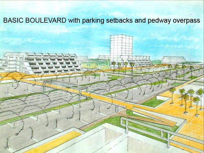
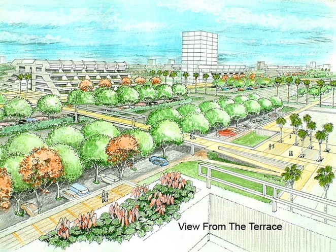
The Flow Boulevard design is in itself a response to making the automobile work more effectively by evolving the corridor urban form. The up dating of corridor urban form is no trivial event. Family and empty nester housing types should be accommodated. Auto dominated busy streets can take residential qualities away. But if vehicular travel is given necessary setback spacing along the redeveloping blocks, along with keeping through traffic diminished, and elevated pedestrian circulation connecting land uses, plazas, and parks; residential qualities are reinstated. The character of an urban village emerges. The Jane Jacobs environment with a thousand eyes not only brings safety but concern, connectedness, even civic morality.
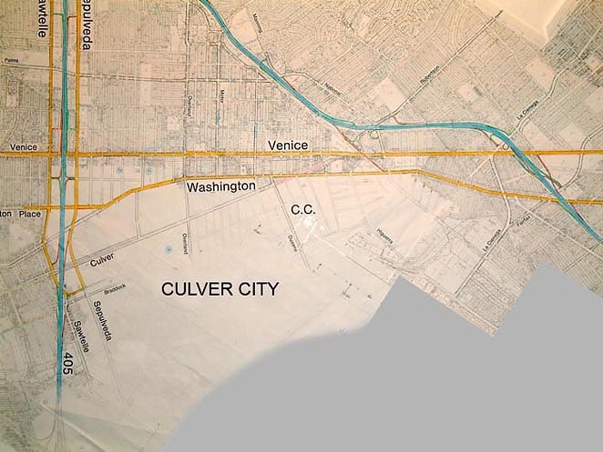
There are approximately 1000 acres between Venice and Washington Boulevards, and between the 110 and 405 freeways. The redevelopment of this area over the next 30 years could bring the much needed, –urban dream community-, that Los Angeles should have. It is conceivable that a similar amount of acreage both north and south of the corridor could redevelop. That would mean 3000 acres redeveloping. As the Flow Boulevard corridor development is proven over the next few years, other corridors could be following the success of the Venice-Washington, Western-Oxford and Sepulveda-Sawtelle corridors. Los Angeles would be transforming!
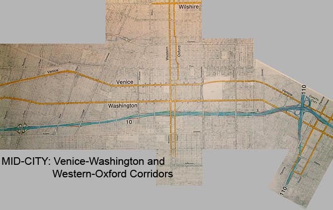
The Venice – Washington Corridor
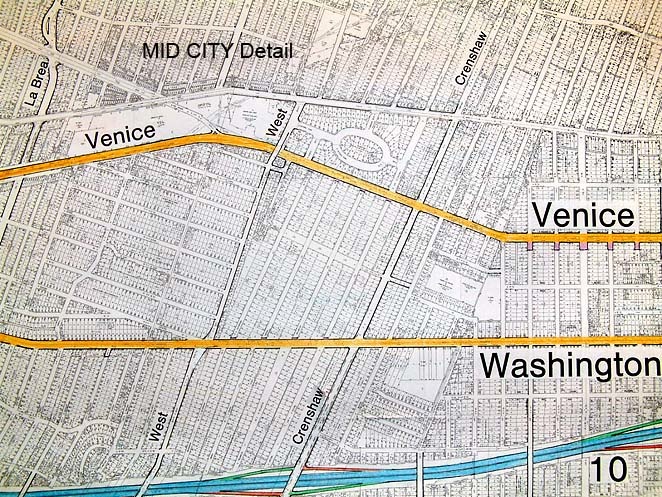
Most of the housing and much of the commercial in the Venice-Washington corridor was built well before 1940. The architectural forms for both of these land uses are inadequate for today’s uses in many instances. Large old houses divided into units and under sized commercial spaces with only street parking.
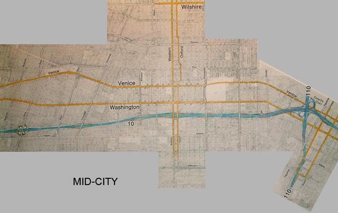
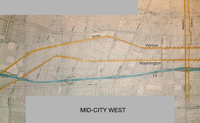
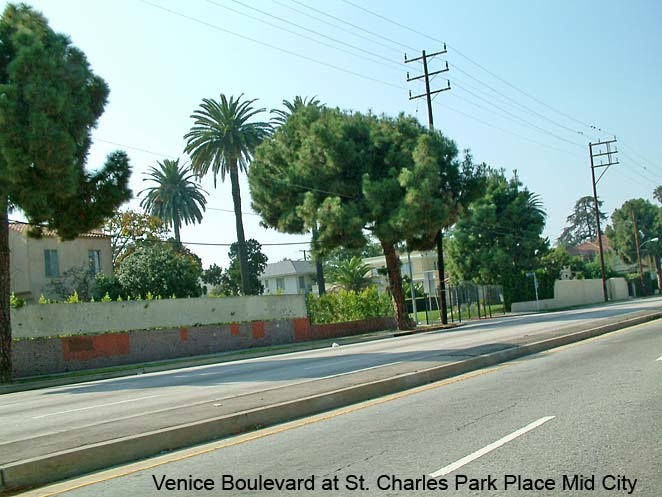
On the other hand, the Venice and Washington Boulevards are nice and wide and under utilized from downtown to the 405 freeway. The neighborhoods between Venice and Washington and bounded by arterials (such as Normandie, Hoover Arlington, Fairfax, etc.) are in approximately 50 to 150 acre areas. I would love to see total transformations on many of these neighborhoods: 1/ The opportunity is to bring new family housing with safe pedestrian circulation to new needed schools, 2/ To bring empty nesters and singles accommodation near employment and urban amenities, 3/ To provide a better parking ratio and to diminish through traffic, 4/ To provide rapid bus transit for the corridor to reduce automobile traffic, and 5/ To bring more appropriate commercial and institutional use with greater access and parking.
It would be appropriate to see; the elevated pedestrian circulation extending through the built environment, family ground/open space oriented dwellings with empty nesters above, and housing and various commercial uses mixed in built form. An advantage to moving up and to a more three dimension organization of built form elements is that there is more “space” up there. There is more opportunity to create vistas, plazas and human scaled environments when the crowded ground plane is left below and the pedestrian level has moved up. In the same consideration, by alleviating the ground plane of certain elements like ground level side walks with little front yards next to them, space for parks can be aggregated for the enjoyment of many. The present two dimensional organizations of lots with buildings overbuilt on them gives way to an incredible number of mean spirited little side yards in apartment buildings and cooped up spaces that box up people’s environment. Use the structure of new buildings to move up into a more spacious experience of environment. Incidentally, there is a lot of privacy up there too. Even though the density of dwelling units per acre is higher, there can be greater spaces between buildings. A more appropriate demographic urban community can have its needs met. A new richer community form relevant to today’s demands can be evolved.
Evolve Urban Socio-Economic Conditions
There are many players, market forces, involved institutions and levels of government at work in such an endeavor as evolving FBs and corridor redevelopment. To begin with I advocate for the people in the corridor now. They should in effect receive a windfall profit through some way, in order to get the redevelopment process going. The longer and more involved the constructive effort, the greater the benefit. See the “Block Corporations” section for elaboration on this point, following below. Other groups, not in the corridor or not buying into the redevelopment, but who benefit indirectly should probably be assessed in some way. I would think that Caltrans would fall into this category. Will Caltrans build or pay for building pedestrian circulation?
If Flow Boulevards takes on long trip traffic effectively solving for the deficiencies of the freeway system, the FB effort should be compensated, or maybe better, participated with. There is a definite play of operation that would occur between the freeways and FBs. Through traffic would remain on freeways where as local traffic and traffic destined to or emerging from the adjacent areas would best be kept off the freeways and directed to FBs. This would give the freeways greater capacity for regional trips by not being congested with local traffic. In the case of the limitation of freeway interchange capacity, this is especially critical. Interchanges seem to be the weak links regarding capacity and they effectively have little or no room for improvement.
The appropriate allocation of gas tax money and property tax money to Flow Boulevard development is of great importance. You might think that I would advocate for co-opting all of the heavy rail and some of the light rail allocations in the future, and you would be right ( read Comments on Rail Transit in the menu sections). The point here is money and financing should go to where problem solving is taking place. The struggle of fighting over money is real; there is a finite amount of it. The budget allocation, the design of where funding goes and when, affects the development process. More attention and public awareness is necessary for a successful result. It is easy to believe that with the great complexity of evolving urban corridors, a great deal of creativity will be necessary. Who does what and who pays for what, when, and where. Now more than ever, plans need to be explored to see what elements would be involved.
New Blocks and Block Organizations
Flow Boulevard design, construction and evolution through various stages involves the full hierarchy of Transportation and Public Works departments as well as the input of the new functional relationships found in the architectural built environment. New standards should be derived to normalize traffic operation, ingress-egress, and the like so drivers can manage within safe and convenient circumstances to and from new block organizations. It is good that the FB evolves and become an instructive experience itself. It is also good that architects will be involved in giving form and new criteria for these organizations.
Century City is what is called a super block organization. The Fairfield shopping and entertainment portion over parking has raised pedestrian circulation. There is a pedestrian bridge across the Avenue of the Stars. South of Olympic there is a residential village free of streets chopping it into separate parts. However, Century City has no Flow Boulevard with high volumes of through traffic. It is more of a destination type of function than a place along a corridor. So it is not the same, but you can begin to see what pedestrian friendly urban spaces can be like.
Century City was also essentially master planned at one time. Again it is different in that the FB corridor would be developing at different times in different ways and yet would be expected to add up to a functioning and experiential whole as time goes on and also as it continued to change. It is a different dynamic and all the more reason to start exploring the possibilities sooner rather than later.
Block Corporations
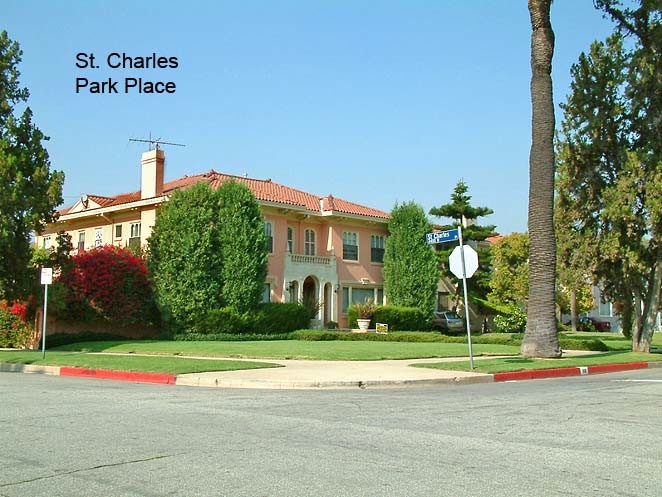
Before I discuss block corporations it would be fitting to mention that some neighborhoods might not care to redevelop. The St. Charles Place area between, Crenshaw, West, Venice, and Washington boulevards could take that choice. I would suspect however that they just might hold out twelve years or more to see how to cash out big time. It is now a unique neighborhood in that they have already cut themselves off from through traffic.
As mentioned above, financing redevelopment is a major area of creativity as well. The following discussion will focus on the built form scale of the corridor redevelopment, not the overall FB corridor itself. Aggregation of land should be made to be voluntary, entrepreneurial, - the best game in town-. By this I do not mean risky, I mean safe and lucrative almost to the point of being an “inside deal”. Of course it will also have to be legal. The objective is to pave the way for smooth transformation of the neighborhoods by taking care of the participants involved.
So in order to aggregate large areas of land, I see block corporations forming. Existing owners would take shares along with other investors and those who are experienced in development. Looking at the situation of the existing property owner, that person would want flexibility to cash out or to get further into the process of rebuilding the community. Through ownership of block corporation stock, the flexibility is achieved. The corporation plans, works with the city for approvals and staged construction proceeds. Again in the individual’s case, where the home is to be removed to make way for new construction, the individual is compensated and accommodated in some contractual prearranged agreed upon manner. Temporary housing during construction, first right of purchase on units, custom design to fit one’s needs can be arranged for in the corporate agreement. The owner of stock can always cash out at anytime if their objectives change. The reason one would hold on to stock is that it appreciates. With preferred stock, original property owners may have preferential opportunities common share stock owners would not have. The objective is to make such arrangements fair and normal. Maybe the American Institute of Architects can draw up a standard block corporation contract ! The intension is to make the necessary relationships part of the corporate by laws and structure agreements from the outset so smooth equitable transactions are made.
The city or state would oversee, to some extent, the performance of block corporations. Experienced developers could assist or lead such corporations. Non-profit entities active in development, deep pocket corporations like a General Electric, or building system corporations could have interest in the block corporation renewal effort. There are many possibilities. For the investor in block corporations, there could even be mutual funds comprised of multiple block corporation entities packaged into Real Estate Investment Trusts (REITs) that traded on the New York Stock Exchange and were regulated by the Securities Exchange Commission. Serious, safe, honest, fluid investment vehicles that in turn help develop the renewing corridor.
The idea of having block corporations is not only for the aggregation of large areas of land but so that the development entity is large enough and sophisticated enough to perform at the scale of the task involved. Part of that task is to simplify and accommodate the process for the existing owners through the redevelopment. It is assumed that many of the existing owners have businesses and jobs in the corridor itself. These relationships need continuity. It would also be the intent of the block corporations to involve people in the community to step up and into the various development roles required by the redevelopment process.
The city would not only be required to do the overall transportation planning for the corridor redevelopment but should participate in providing the legal, economic, market, and basic social research and planning necessary to provide the development activity. This means identifying the new relationships, connecting the institutions and disciplines involved, developing the necessary documents or requirements involved and interrelating that into procedures and implementation activity. The city benefits greatly by doing so. Why would it not do its part?
As an example of clarifying matters, presently proposed developments are required to make traffic studies for their projects. There are many procedures and hoops to get over. Developers are required to make mitigation measures, public works improvements and the like, to lessen traffic impacts made by the new vehicular trips generated by the proposed development. Any large project is facing a stacked deck against them because of the overall deficiencies in the central L.A. area due to three freeways not being built. The process is upside down. The city has to get their traffic mitigation plans together and show how their plans and procedures can allow redevelopment to occur.
Infrastructure Development
With large scale redevelopment, a large part of the city is being taken apart and put back together again. Or maybe the existing structure is being over laid by the new structure which in turn dissolves the existing structure. It’s not easy to tell at this point; maybe some of both? To be sure it would be done on an incremental basis, but that occurs now in Los Angeles, be it in a smaller and slower way. The difference is that now, change is at the architectural scale. The organization of infrastructure does not change particularly.
With the Flow Boulevard (FB) and large scale community renewal, the infrastructure is changing, as well as the architectural scale. I have explained how the FB and the raised pedestrian circulation are three dimensionally organized and present a new set of relationships. Now we recognize other new elements of infrastructure.
The grove of trees filling the setback between the FB and architecture is first of all a sound and visual separation. They also visually cover up a lot of parking. The trees would be watered with gray water, shower and washing water but not toilet water, from the adjacent new buildings. The new buildings would collect, treat and are part of a distribution network to water the trees and other landscape. Other water collected from roof, parking, or other non-porous surface areas would be filtered if necessary and directed to drywells, porous swales and decorative stream beds to allow water to seep into the subsoil. The design of storm water run off, in this case is being totally redesigned to a conserving system. This way, pollutants do not flow into the Santa Monica Bay in typical runoff fashion, but help regenerate subsoil moisture in the corridor and a sustainable environment. This is new infrastructure.
In another part of this statement I explained how three dimensional organization would change how ground space between buildings would change. And that by moving up in the built environment, relationships, priorities, and opportunities take place. Today the residential street is circulation, orientation, visual and recreational open space, among other uses. That would all change in that residential streets in the redeveloped neighborhoods would essentially be omitted or greatly subordinated. That is because it is a wasteful use of ground area in a high density organization. New criteria for governing orientation, circulation and open space would need to be identified to provide for aesthetic and functional qualities as well as for safety, -fire and police protection.
The possibility of introducing renewable energy sources into the reformed community infrastructure is a possibility as well. Buildings, plazas, and pedestrian bridges could be solar collectors linked into a community power grid. If we can do it, do it as well as we can! Again research and design exploration needs to take place to take advantage of the opportunity community redevelopment presents. The necessary elements should be identified and the same questions come up; who pays for it, who builds it and when?
Providing basic utilities of water, power, gas and communications is a whole area of possible change. Do you still bury utilities or are there other more open ended and flexible layouts?
The sequencing of construction over 100 or more acres of neighborhood to be transformed requires new study and awareness. It does not happen with one developer or contractor. In typical critical path understanding, one knows how interdependent things can be. It seems it could be very complex. Yet on the other hand, you have a functioning neighborhood now. That neighborhood builds the new neighborhood. The truth of whether it is complex, or it is simple because of some wonderful organizing principle, is yet to be found out. Let’s get going !
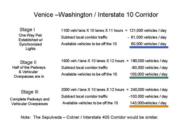
Venice – Washington Flow Boulevard Capacity
Today, the average daily trips (ADT, using this denote cars not people) on Venice and Washington Boulevards add up to about 45,500 vehicles combined. That is about 530 vehicular trips per hour per lane on average. The ADT on both the 10 and the 405 freeways are over 300,000 trips per day on each freeway. This comes out to about 2500 vehicular trips per hour per lane on average. This is about five times the usage of the present Venice and Washington Boulevards.
The following chart summarizes the anticipated improved capacity by way of the Flow Boulevard through the three stages in the Venice-Washington corridor.
You will note that there is the capacity projection for each stage, from which local Venice-Washington corridor traffic is subtracted from it. The resulting excess amount is determined as the amount of traffic that can be expected to be taken off the 10 freeway for each level of staged development of the Flow Boulevard. These are rough numbers. Vehicular travel is being addressed not person trips. When you talk person trips moving in a corridor you must define the number of persons per vehicle and by mode. If rapid bus travel becomes attractive it can affect the number of cars on a particular FB and therefore freeway. So bear with me, I am an architect not a traffic engineer.
But by the third stage of FB improvement it is suggested that the Venice-Washington FB can effectively receive 140,000 regional trip ends and local central L.A. traffic that should not be on the freeway. By regional trip end, I mean a trip that has a regional trip length of say 10 miles or more that has an end in the FB corridor. It could be a trip that has an end effectively anywhere along the Venice-Washington Corridor from the 405 to downtown.
This is the thesis of the congestion busting Flow Boulevard concept. Develop boulevards that essentially serve the central Los Angeles area and have a rapid transit component to it. This would allow the central segments of the freeway system to essentially serve long range region trips that are effectively going through the central L.A. area. This extends the “life” of the freeway system, which is no small accomplishment, and the FB becomes the backbone to redevelop and transform Los Angeles into a truly great city.
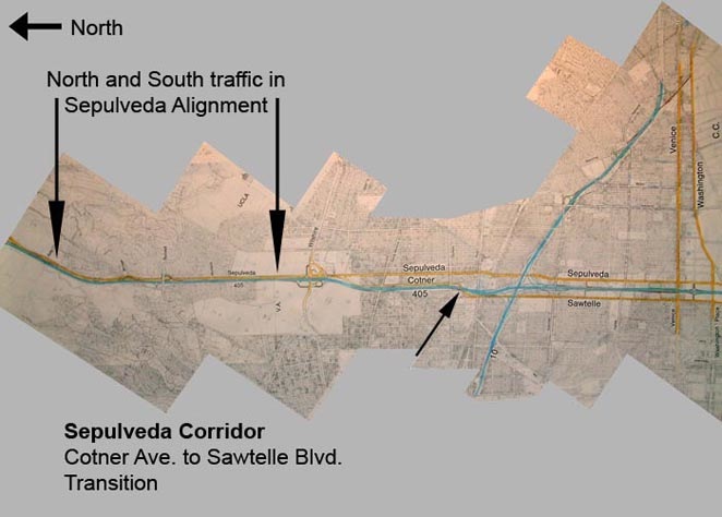
Sepulveda – Sawtelle Flow Boulevard Capacity
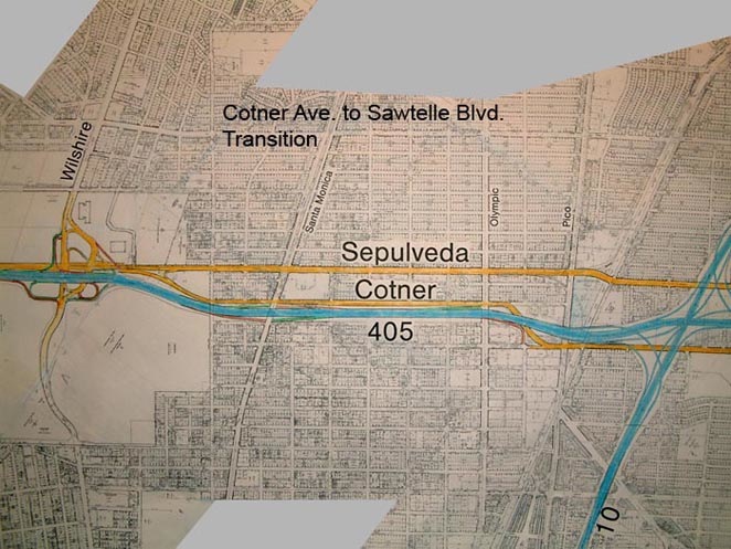
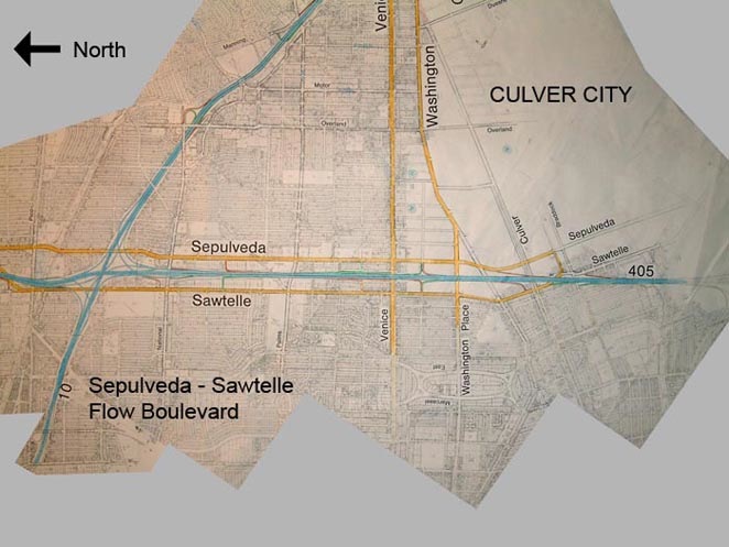
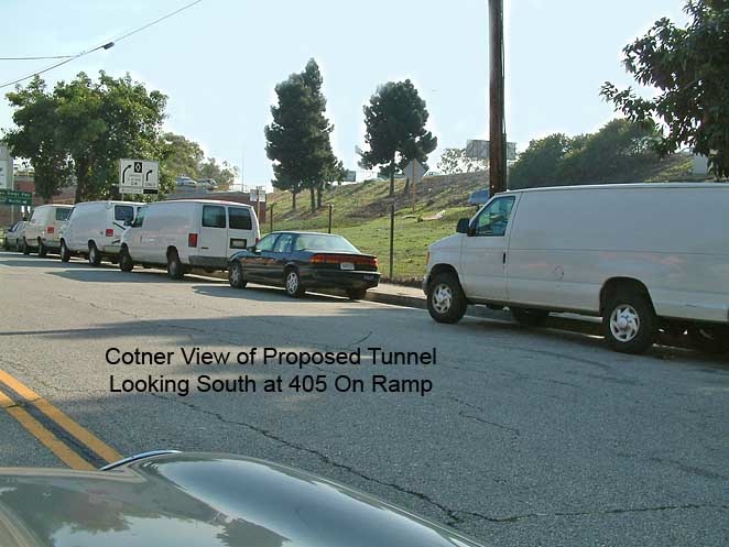
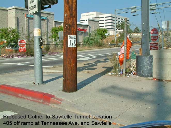
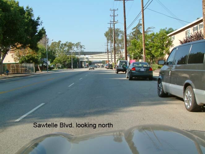
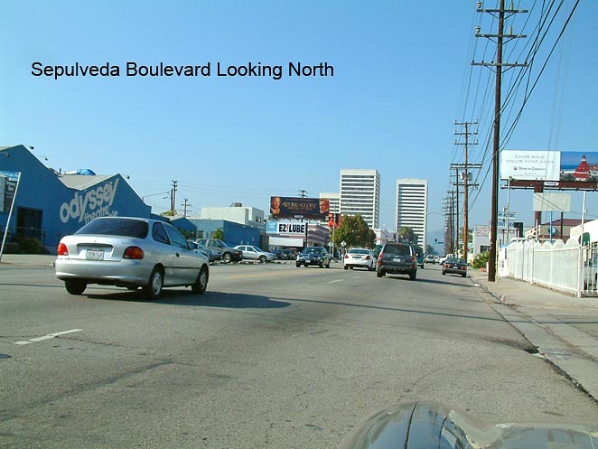
The Sepulveda-Cotner (Sawtelle) FB would have similar beneficial stage improvement capacities. Again, taking local traffic off of the 405 would be part of the objective. This corridor is somewhat unique in that the 405 attracts a lot of trips due to its diagonal alignment to the grid, it picks up practically all of the coastal regional trips and there is not another freeway alternative without going quite away inland. This corridor needs traffic improvement more than it needs community renewal.
Western – Oxford Flow Boulevard Capacity
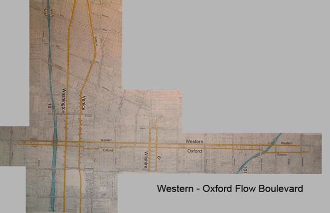
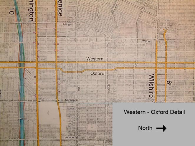
In the Western-Oxford corridor, it would be assumed that there would be lower vehicle/lane volumes. The streets selected to become the FBs are a bit more confined along with commercial and residential. There are many cross streets to manage and I would expect lower average speed in this corridor. With all that said it would still be a winner regarding alleviating congestion and the corridor should welcome redevelopment.
Western Avenue is of course one of the longest straight urban streets in the world. I have not studied the alignment much, but it would seem desirable to hook up in some way with the existing route two (Glendale freeway) and provide continuity with a Western-Oxford FB all the way down to the Palos Verdes Peninsula. With this concept in mind in the chart below I reference possible traffic coming off the 110 (Harbor Freeway).
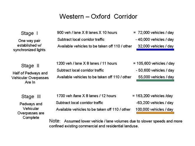
The third stage shows an excess capacity of 100,000 vehicles implying that they could come off the 110 or other adjacent facilities. That is a lot of vehicles and a lot of potential growth. Knowing the continued job growth of the L.A. harbor area and the need to revitalize south L.A. it would seem a natural way to facilitate both.
Rapid transit with buses would be a definite beneficiary in this corridor. There would be lots of home to work, or school, or shopping, or other kinds of trips. Since the FB is responsive and flexible by being improved were needed as needed, it would still have continuity end to end. The improving facility, would I am sure; stimulate community redevelopment with its improved purpose and functionality.
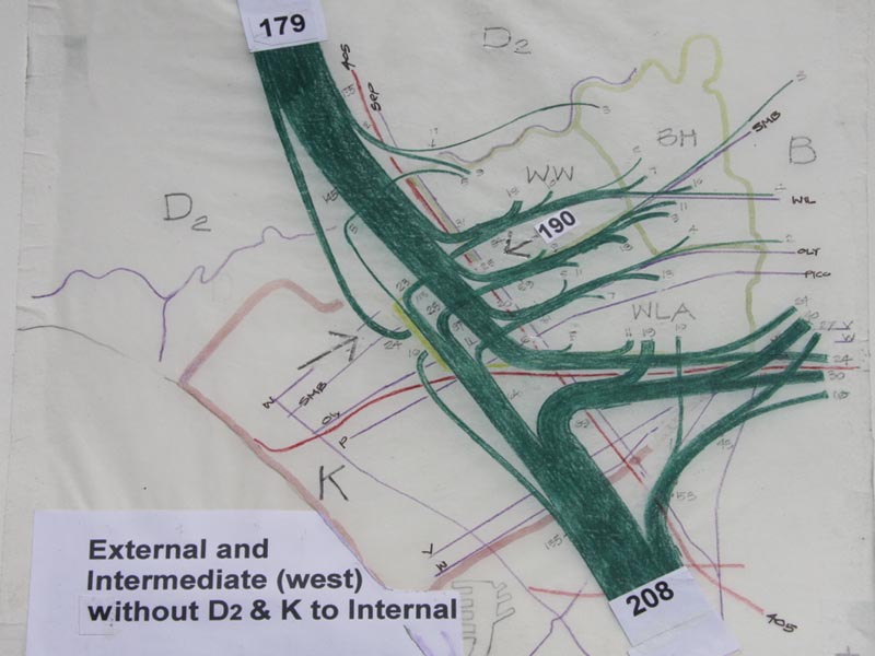
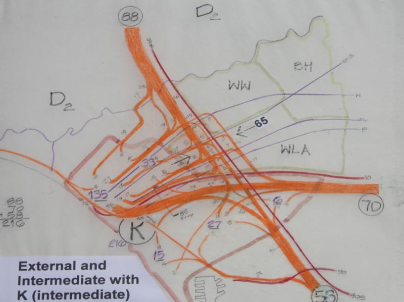
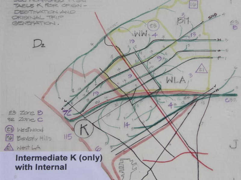
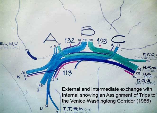
This image and the following two show travel demand to the West LA area. Before this analysis was made the Westside, and I believe Metro as well, did not understand that most of the trips come from the north (valley) and the south (South Bay); only a smaller percentage come from the east. Diagrams; External and Intermediate zones exchanging with Zone A (Westwood, Beverly Hills and West LA/Palms), next External and Intermediate Zones exchanging with Zone K (Santa Monica) and next Intermediate Zone K exchanging with Internal Zones A, B and C (the LA Basin). If the AIA is going to stand for urban design excellence it should make this kind of analytical technique available to its urban designers so that they can really understand the circulation problems to be solved for. The proposed solution to eliminate West LA congestion would cost about $300,000,000 exclusive of the 405 HOV lane and the Expo Line. The City of LA has a planning study that adds a north-south rail transit line to connect the proposed east-west rail lines from LAX to the Expo to the Subway Extension at the VA and a “rail tunnel” from Westwood to the Valley as a potential Measure R project. These rail lines add up to about $15 Billion dollars and would bring new development pressures to the Westside thereby assuring renewed traffic congestion by way of inducing new traffic attracting development.
10. Raised Pedestrian Circulation and Open Space, Vehicles Below
The premise is quality elevated pedestrian environment made architecturally and transportation that is not congested at grade. In the LA Basin and smaller cities it means corridors. In the suburbs it means nodes that introduce walking and small scale vehicle environments beginning to transform the great sprawl of Los Angeles into higher density environments with reduced VMT with a reduction of transportation scale and costs; buses not trains, short trips not long, and support for electric mobility of small cars, electric motor cycles and bikes, walking and biking. So the transformation of LA environment is driven by architecture with three dimensionally organized circulation in mind. Hopefully the AIA can take a leadership role in this transformation influencing politicians, educating the public and initiating the Metro program “Calls for Projects”, prompted by the many jurisdictions of LA County.
Los Angeles City and County need urban design and architects are the appropriate design professionals to carry out the leadership role. Of the many projects associated with 200 miles of Flow Boulevard and related similar facilities in the suburbs I would think these projects could add up to be some 80 square miles of urban design.